IMPORTANT NOTE: none of these brown trails are marked or even visibly trodden, they have been transferred from a GPS carried by someone walking those hikes. Most have very steep sections and should be attempted only if you have a good sense of orientation, have experience in cross-country hiking and are fit and healthy. Making these hikes is at your own risk.
Please text us when you start, telling us which hike you will attempt and how far you want to walk, and then text again when you are safely back. Allow an hour for each 1-3 km distance, depending on the steepness (see height data below)!!!
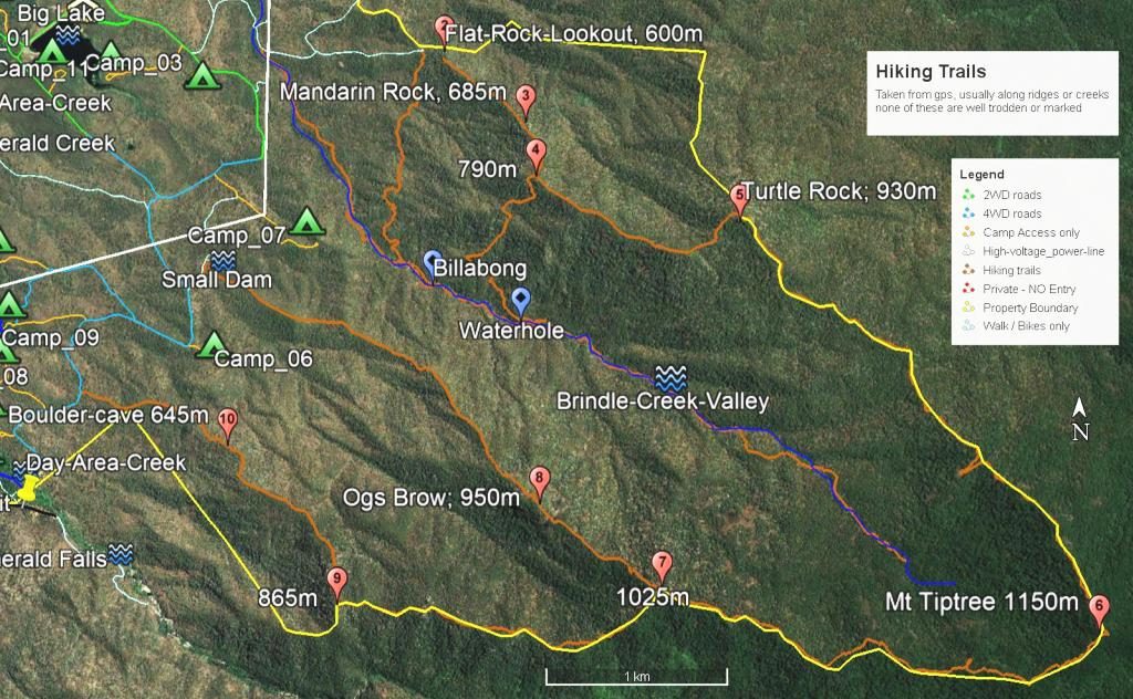
- The easiest hike is about 1km from its starting point (490m high) to Boulder-cave (645m high).
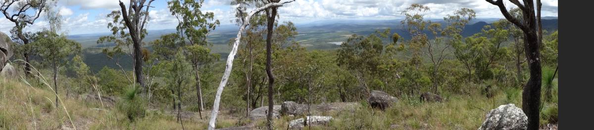
Some massive boulders form a cave; great distant views.
You can continue another 1.3km up the ridge to Hill 9 (865m high) for even better views. - The hike to Ogs Brow is 2.7km from its starting point (510m high) and you can continue another 900m to Hill 7 (1025m high)
- The hike up Brindle creek is 2.8km from starting point (470m high) to billabong (540m high), 3.5km to waterhole (600m high), or 5.8km to headwaters (900m high), all one -way. This trail requires frequent rock-hopping
- Starting at Flat-Rock Lookout (600m high) you can hike 650m up the ridge to Mandarin-Rock (685m high), or 1km to Hill 4 (790m high), or 2.5km all the way to Turtle-Rock (830m high).
- From Turtle-Rock (830m high) to Mt Tiptree (1150m high) is about 3.6km along the ridge
- From Mt Tiptree (1150m high) to Hill 7 (1025m high) is about 3km along the ridge
- From Hill 7 (1025m high) to Hill 9 (865m high) is about 2km along the ridge
- From Flat-Rock Lookout (600m high) down to the Brindle Billabong (540m high) is about 2km
- From Hill 4 (790m high) to the Brindle Waterhole (600m high) is about 1.5km
Enjoy and stay safe